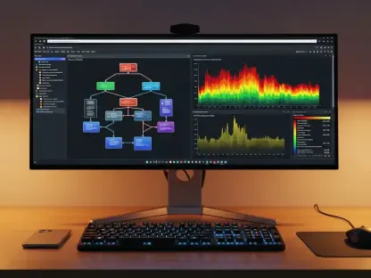

What if the sprawling complexity of a cityscape or the intricate details of a coastal ecosystem could be captured in a virtual environment with stunning precision? This isn’t just a dream for developers—it’s the reality ushered in by the latest update to a powerful toolset integrated with the Unity game engine. Unveiled to the geospatial and gaming communities, this release marks a transformative moment for those looking to build immersive 3D applications that mirror real-world environments. With industries from urban planning to environmental science hungry for richer data visualization, this update promises to redefine how developers craft interactive, data-driven experiences.
Why This Update Is a Game-Changer
The significance of this release lies in its response to a pressing need: bridging the gap between raw geospatial data and actionable, engaging 3D visualizations. As cities grow smarter and environmental challenges become more urgent, professionals across multiple sectors demand tools that can handle massive datasets while delivering intuitive user experiences. This SDK update stands as a pivotal advancement, equipping developers with cutting-edge features to meet these demands head-on. It’s not just about prettier visuals—it’s about empowering decision-makers with tools that turn complex information into clear, interactive insights.
Moreover, the timing couldn’t be more critical. With technologies like Lidar becoming more accessible, the volume of high-fidelity spatial data is exploding. This update ensures developers aren’t left struggling with performance bottlenecks or clunky interfaces. Instead, it offers a seamless way to integrate vast datasets into Unity, paving the path for applications that resonate with real-world problems, from designing sustainable urban spaces to monitoring natural disasters in intricate detail.
Unleashing the Power of Point Cloud Visualization
One of the most striking advancements in this release is the ability to render massive point cloud datasets with remarkable efficiency. Derived from Lidar scans, these datasets—often comprising millions of data points—capture everything from urban skylines to rugged terrains in meticulous 3D detail. The new Point Cloud Layer feature uses an optimized Hierarchical Level of Detail structure, processed through ArcGIS Pro, to ensure that even the heaviest datasets don’t bog down performance. A striking example comes from a dataset of Barnegat Bay, NJ, where vibrant RGB rendering brings coastal features to life in a way that feels almost tangible.
This capability opens doors for industries like infrastructure analysis and environmental monitoring, where precision is non-negotiable. Imagine an urban planner visualizing every nook of a city block to optimize traffic flow or a scientist studying erosion patterns along a shoreline with unprecedented clarity. While styling options for these layers are currently fixed by data publishers, plans are underway to introduce APIs for customization, promising even greater flexibility in how such data is presented. This feature alone positions developers at the forefront of data-heavy visualization, balancing raw power with practical application.
Transforming User Engagement with Intuitive APIs
Interactivity forms the heartbeat of modern applications, and this update delivers with two new methods in the ArcGISView class designed to simplify data exploration. Known as IdentifyLayerAsync and IdentifyLayersAsync, these APIs allow users to retrieve detailed metadata from 3D object scene layers through simple actions like tapping or clicking. Gone are the days of wrestling with complex raycast operations; now, a single interaction can reveal a wealth of information about a specific feature, making data exploration as intuitive as browsing a smartphone.
This enhancement caters directly to the growing expectation for user-centric design in geospatial tools. Whether it’s zooming into a building’s attributes for architectural review or navigating to a specific environmental feature for analysis, these tools streamline the process. Upcoming samples on dedicated repositories will showcase practical uses, such as visually highlighting selected elements, addressing a clear demand for seamless, engaging interfaces. Developers can now focus on crafting experiences that captivate users rather than getting lost in coding intricacies.
Elevating Visual Customization with Building Layers
Rounding out the major updates is a powerful addition to building scene layers: the ability to apply custom materials through the MaterialReference property. This feature completes the toolkit for tailoring the appearance of surface-rendering layers, allowing developers to adjust visuals based on specific filters like construction phases or internal levels. For instance, in a visibility analysis, visible areas might be rendered in a bright hue while obscured zones take on a muted tone, aiding critical decision-making in urban planning projects.
Such customization proves invaluable for professionals who rely on clear visual distinctions to communicate complex ideas. Picture an architect presenting a multi-phase development plan, where each stage stands out through distinct materials, making stakeholder discussions more effective. This level of control ensures that applications aren’t just functional but also visually compelling, tailored to the precise needs of a project or audience. It’s a step toward making 3D geospatial tools not only powerful but also uniquely expressive.
Echoes from the Industry: Expert and User Feedback
The excitement surrounding these enhancements is palpable among those shaping the field. Mike Branscomb, a driving force behind the SDK, notes, “These features are opening entirely new workflows, pushing the limits of what developers can achieve in 3D geospatial spaces.” Product manager Rex Hansen echoes this sentiment, highlighting how user feedback shaped the focus on performance and interactivity to meet current demands. Meanwhile, marketing lead Shimona Lahiri points to tangible benefits: “Professionals from urban planning to environmental science will immediately see how these tools breathe life into raw data.”
Early adopters have shared similar enthusiasm, with reports of smoother workflows when handling point cloud datasets that once strained systems. A developer working on infrastructure mapping described the rendering speed as a “night-and-day difference,” underscoring the practical impact. These voices, blending expert insight with real-world experience, paint a picture of a toolset poised to redefine industry standards, delivering results that resonate across diverse applications.
Getting Started with the New Features
For those eager to dive into these advancements, the path is straightforward and well-supported. The updated SDK is available through the Unity Asset Store, with comprehensive release notes on the Esri Developer website guiding initial setup. To harness point cloud visualization, developers can process LAS data into an optimized structure using ArcGIS Pro, selecting attributes like color or intensity for rendering. Integrating the new identify APIs into Unity scripts is equally accessible, requiring only defined start and end points to capture user interactions and fetch metadata.
Experimenting with custom materials for building layers offers a creative outlet—try applying distinct visuals based on analytical goals, such as distinguishing visible from hidden areas. Upcoming examples on the Unity Maps SDK GitHub repository will provide deeper insights into advanced techniques like feature highlighting. These practical steps ensure that anyone, from seasoned developers to newcomers, can tap into the SDK’s potential to build impactful 3D applications that stand out in both function and form.
Reflecting on a Milestone in Geospatial Innovation
Looking back, the release of this updated SDK marked a defining chapter in the journey of geospatial application development. It delivered tools that tackled the complexities of massive data visualization, elevated user engagement, and offered unprecedented customization, empowering developers to craft experiences that mirrored the intricacies of the real world. The enthusiasm from industry leaders and early users alike highlighted a shared belief in its transformative impact across fields hungry for deeper insights.
As the dust settled, the next steps became clear: developers were encouraged to explore these features, integrating them into projects that could reshape urban landscapes or safeguard natural environments. Keeping an eye on forthcoming updates and sample resources promised to further unlock potential, ensuring that this milestone was just the beginning of a broader evolution. For those in the geospatial arena, the tools had arrived—ready to turn vision into vivid, interactive reality.